 SURFACE WINDSPEED AND DIRECTION (1 BARB=10kt)
 |
 850MB WIND ANALYSIS (UPDATED EVERY 06HRS)
 |
 PHILIPPINE HOURLY WIND ANALYSIS
 |  SOUTHEAST ASIA WIND ANALYSIS
 |
 10 M WIND ANALYSIS
 |  10 M WIND ANALYSIS SE ASIA
 |
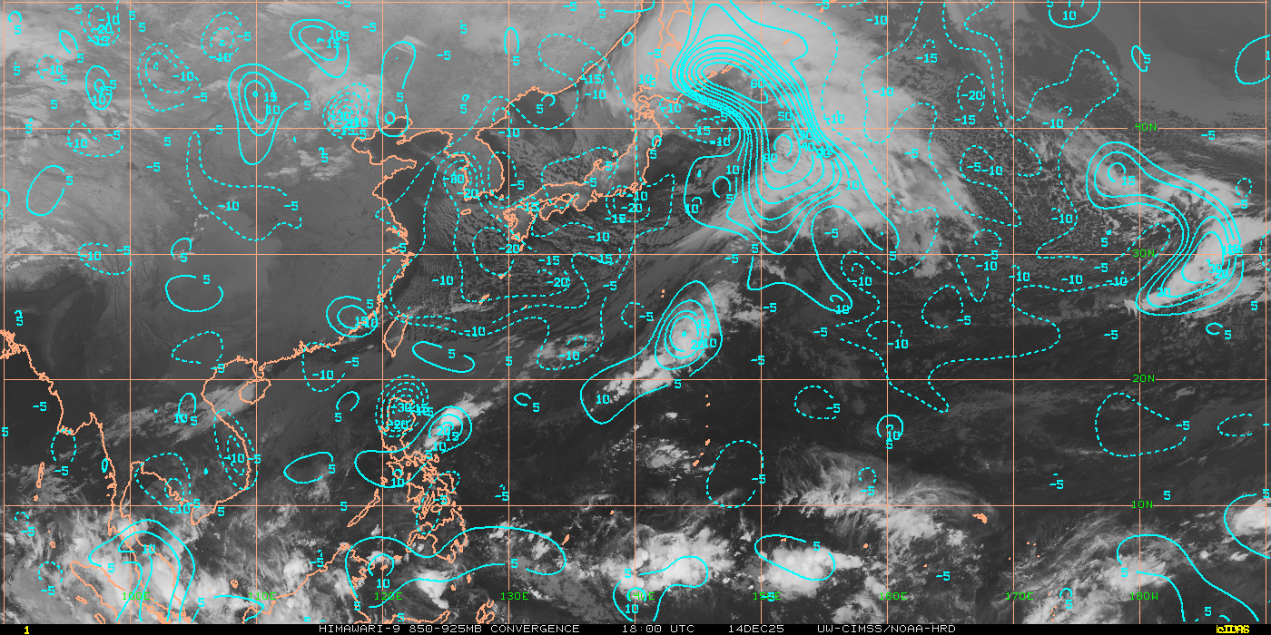 REAL TIME LOW LEVEL CONVERGENCE
To identify potential areas where TC development may occur, maturation and sustainment of a TC. Strong TC convergent inflow near the surface can pinpoint those regions which are in favorable environments
REAL TIME LOW LEVEL CONVERGENCE
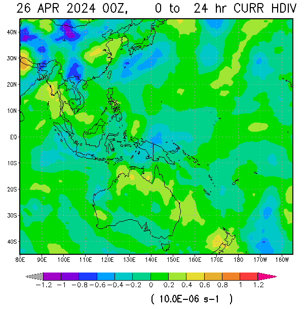
To identify potential areas where TC development may occur, maturation and sustainment of a TC. Strong TC convergent inflow near the surface can pinpoint those regions which are in favorable environments | 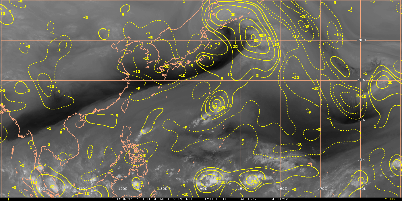 REAL TIME UPPER LEVEL DIVERGENCE
To identify potential areas where TC development may occur, maturation and sustainment of a TC. Strong TC convergent inflow near the surface can pinpoint those regions which are in favorable environments REAL TIME UPPER LEVEL DIVERGENCE
To identify potential areas where TC development may occur, maturation and sustainment of a TC. Strong TC convergent inflow near the surface can pinpoint those regions which are in favorable environments |
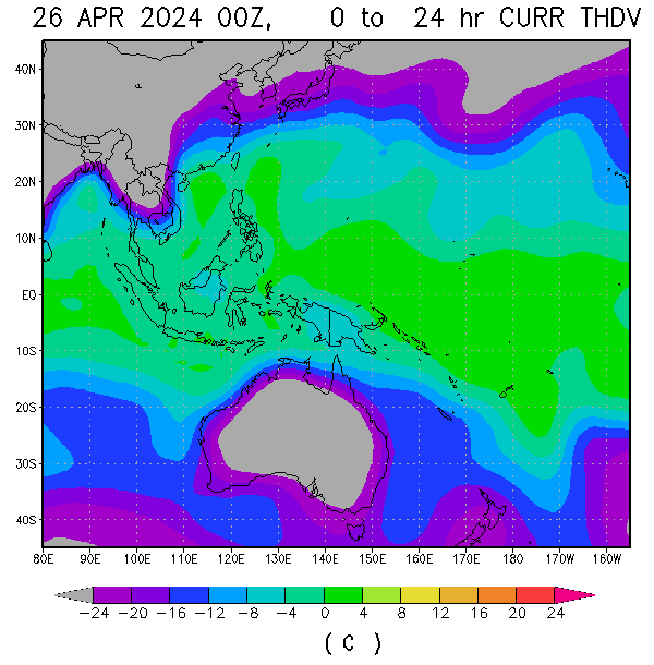 VERTICAL INSTABILITY (°C)TC Formation Threshold above 1.64°C (The vertical average temperature difference between the equivalent potential temperature of a parcel lifted from the surface to 200 hPa, and the saturation equivalent potential temperature of the environment, for each 5° by 5° sub-region)


No comments:
Post a Comment