CLICK HERE FOR WEEKLY FORECAST
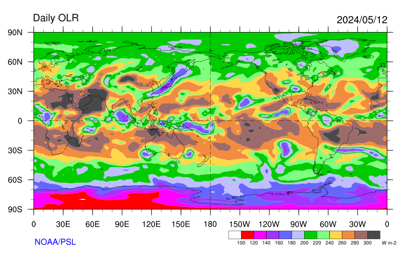 REAL TIME DAILY OLR (OUTGOING LONGWAVE RADIATION) POSITIVE: DRIER THAN NORMAL; NEGATIVE: WETTER-THAN NORMAL | 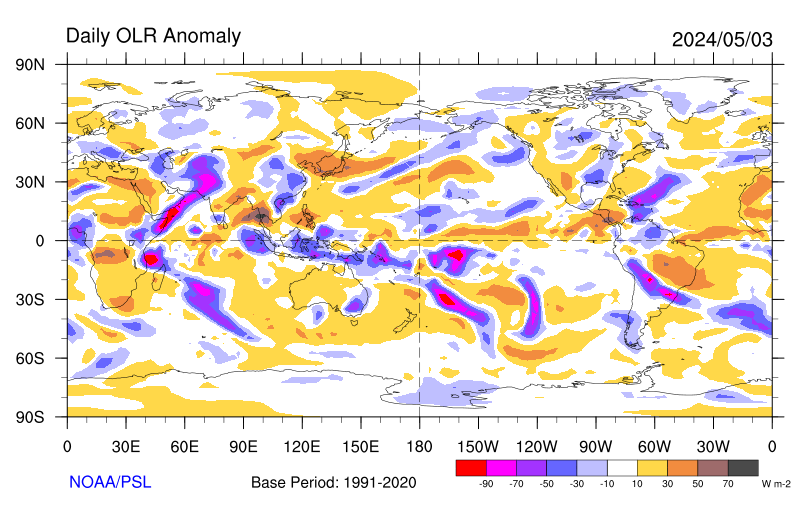 WEEKLY OLR ANOMALIES POSITIVE: DRIER THAN NORMAL; NEGATIVE: WETTER-THAN NORMAL | ||
 3 WEEK FRAME OLR ANOMALIES | 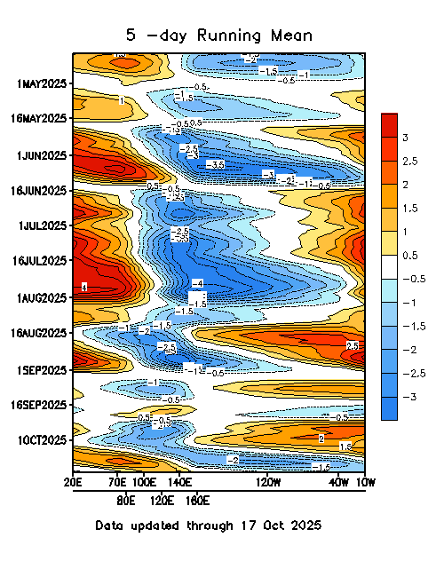 MADDEN JULIAN OSCILLATION INDEX POSITIVE: SUPPRESSED RAINFALL, NEGATIVE: ENHANCED RAINFALL | ||
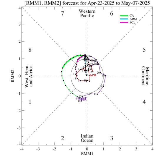 LAST 90DAYS PHASE OF RMM1 AND RMM2 CLICK TO SEE VALUE TEXT When the index is within the centre circle the MJO is considered weak, outside of this circle the index is stronger and will usually move in an anti-clockwise direction as the MJO moves from west to east. | 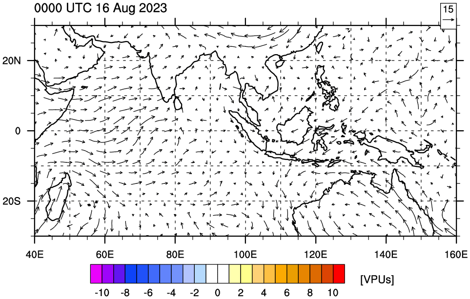 Regional TRMM 3B42 rain rates, KW filtered 200 hPa VP anomalies, and 200 hPa GFS Wind anomalies | ||
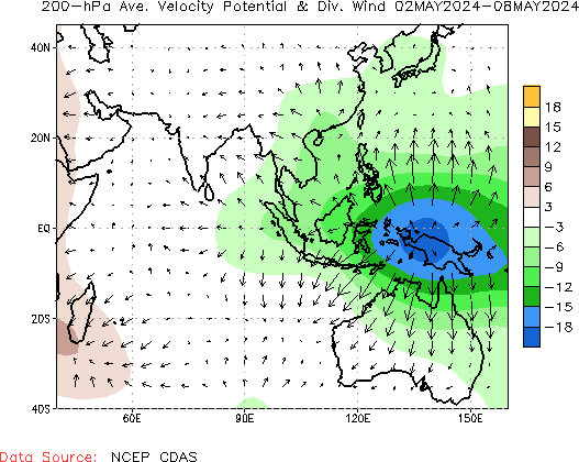 200-hPa Velocity Potential: Positive (Brown) unfavorable conditions for precipitation; Negative (Green) favorable conditions for precipitation | 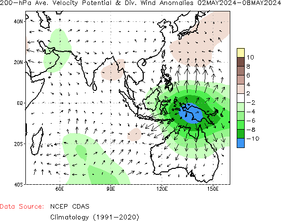 200-hPa Velocity Potential Anomalies: Positive (Brown) unfavorable conditions for precipitation; Negative (Green) favorable conditions for precipitation | ||
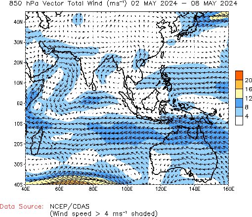 850HPA WIND | 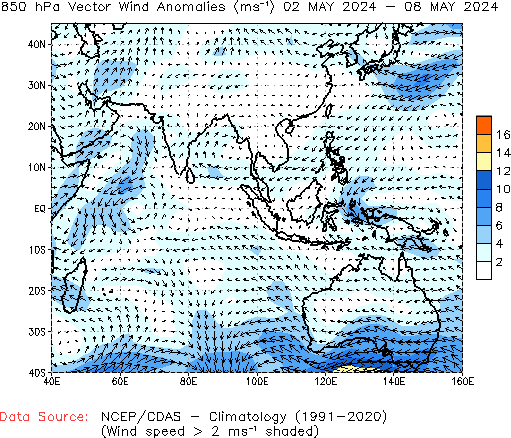 850HPA WIND ANOMALIES 850HPA WIND ANOMALIES |
AMOUNT OF CLOUDINESS (PHILIPPINES)
Blue shading is an indication of enhanced cloudiness while orange shading is an indication of suppressed cloudiness
 |
Past 7 days Animation Negative shading is an indication of enhanced convection and rainfall while positive shading is an indication of suppressed conditions |


No comments:
Post a Comment