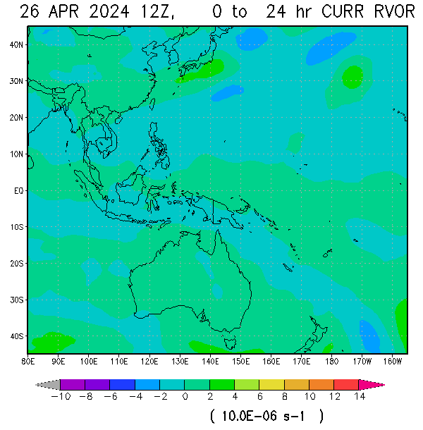
RELATIVE VORTICITY: Vorticity is a measure of curvature in atmospheric flow. A positive value indicates clockwise motion in the northern hemisphere and counter clockwise motion in the southern hemisphere. A positive vorticity environment is conducive to storm development (CLICK TO ZOOM IN, CTRL CLICK TO ZOOM OUT) |
 REAL TIME TROPICAL PRECIPITABLE WATER |
if error occur kindly click link below to open on separate window
NESDIS PRECIPITABLE WATER AND ANOMALIES
 VELOCITY POTENTIAL. Velocity potential anomalies are proportional to divergence with GREEN corresponding to regions in which CONVECTION tend to be ENHANCED while BROWN tend to be SUPPRESSED |
850 hPa Circulation (kt): The 850 hPa circulation determined from a line integral of the wind component tangent to the boundary of each 5 by 5 degree area | 
MSLP (hPa) |
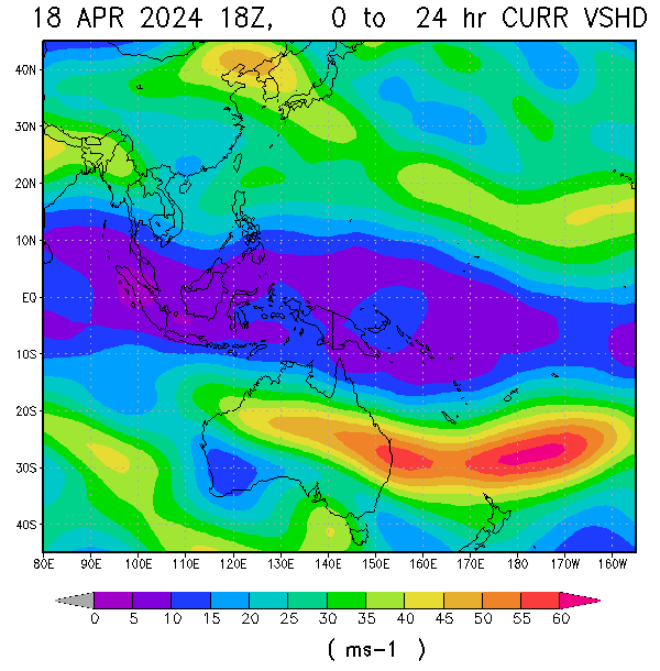
WIND SHEAR: The 850-200 hPa shear determined by averaging the 850 hPa and 200 hPa wind vectors over each 5 by 5 degree area, and then calculating the magnitude of the shear vector | 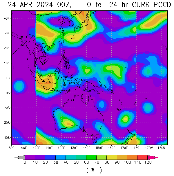
COLD PIXEL COUNT: The percent of channel 3 pixels colder than -40 °C in each 5° by 5° sub-region. All full disk images within 3 hours after and 6 hours before each synoptic time are include, so that this parameter represents the amount of sustained deep convection |
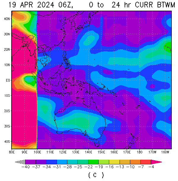
CLOUD-CLEARED WATER VAPOR BRIGHTNESS TEMPERATURE: The average channel 3 brightness temperature over each 5° by 5° sub-region, after the cold pixels in parameter 9 above have been eliminated. This parameter is a measure of mid- to upper-level moisture |


No comments:
Post a Comment